Israeli population
Location Data
Mapping the cities of Israel
About The Map
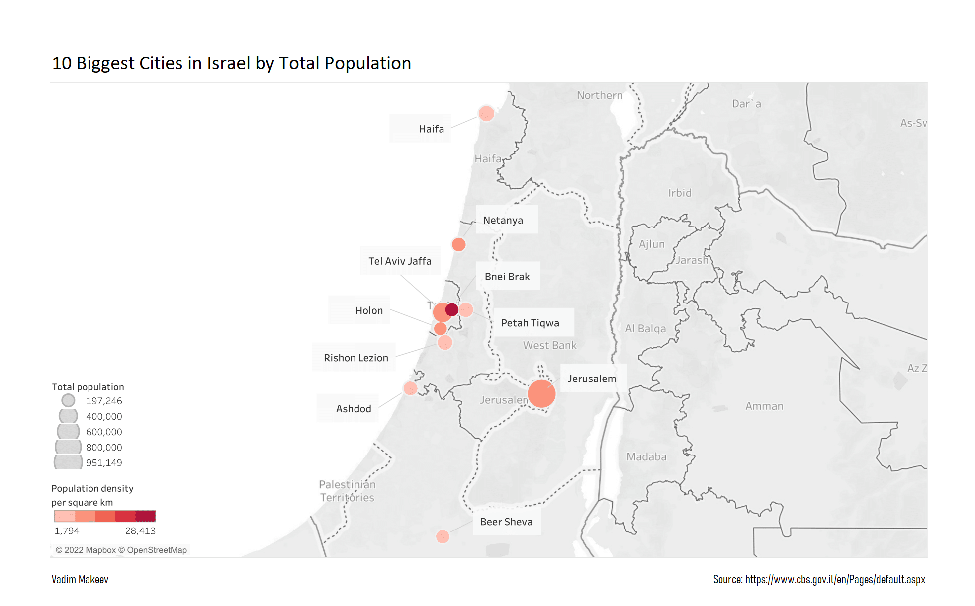
I wanted to see how dense were the 10 biggest cities in Israel, for which Tableau was an ideal choise.
The location data used to populate this map was sourced from a Location Index dataset I created, Which itself was sourced from Wikipedia's GeoHack.
I then merged it with the Israeli Central Bureau of Statistics - 2021 Population Database.
Full Map view
This image is taken from an Interactive Tableau Visualization I created.
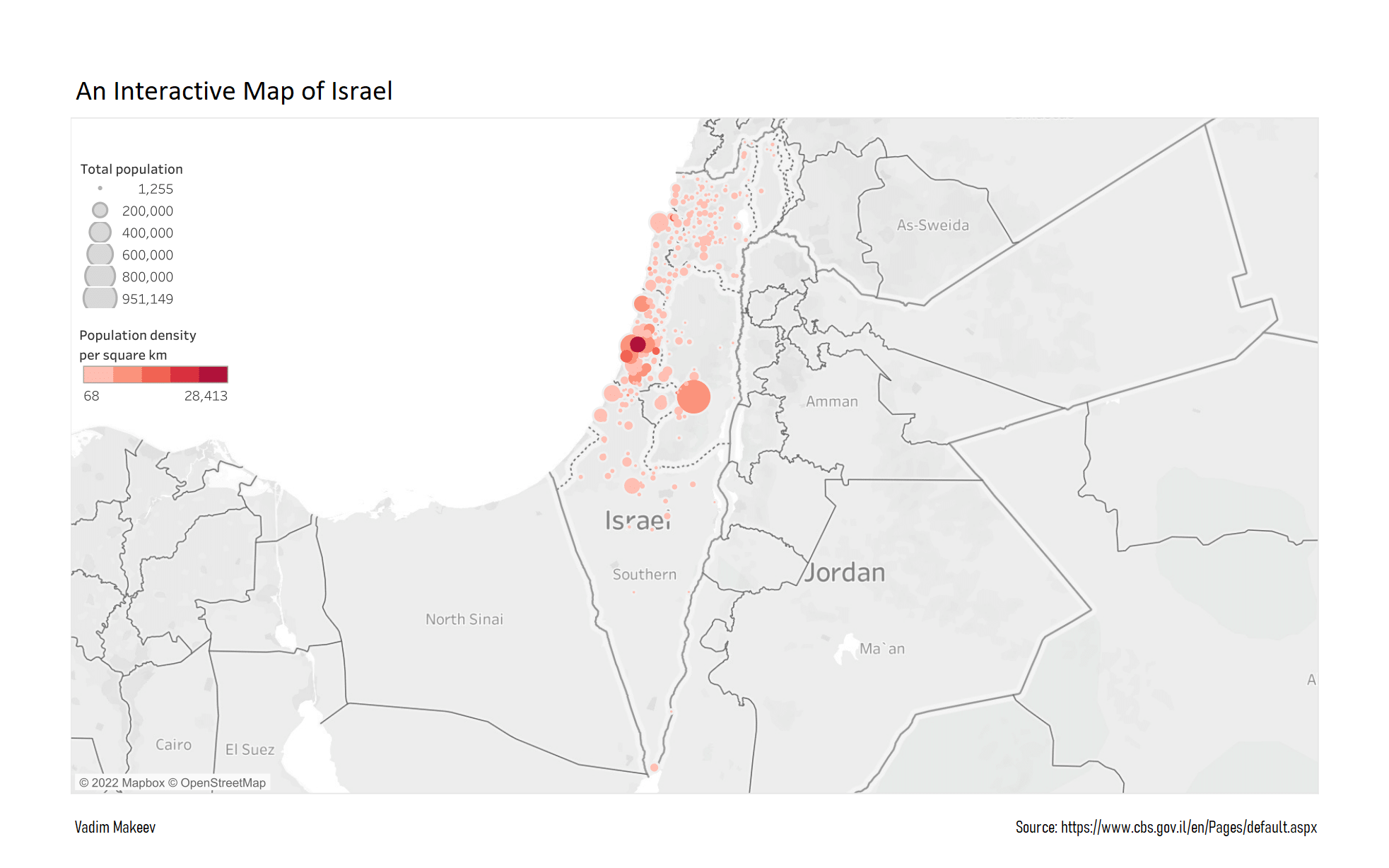
With all 255 Local governments in Israel placed on the map, we can now sync all the data from the Israeli Central Bureau of Statistics to be displayed on the map.
The making of the project
When I first saw the power of Tableau I was immediately hooked!
The elegance and the flow of the program astonished me. After working with SQL, Excel & Python and doing everything in code form,
playing with the parameters on a GUI felt like cheating. Why haven't I used it before?
I was excited about making a map of Israel and connecting it to official government data. But to my surprise, there was no built-in location data for Israel in Tableau (not even a city index), even though an equivalent data set was available for the US. This meant I had to go ahead and make one myself, which was essentially the same story as with the other project I did - The Israeli Knesset by Generations.
After searching for the best data source for Israeli cities, I decided on Wikipedia and its GeoHack tool. However, the location data was in Coordinates format and had to be converted into Decimal Format and merged with existing Authority Symbol No. in correspondence with the Israeli Central Bureau of Statistics data structure, for future manipulations. This resulted in a new data set, containing all 255 Israeli local governments.
The project is on-going and is periodically updated with new data and parameters.
For more works visit My Website.